


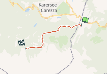

10,9 km | 16,4 km-effort

Tous les sentiers balisés d’Europe GUIDE+


Gratisgps-wandelapplicatie
 SityTrail
IGN / Geografische instituten
SityTrail World
De wereld gaat voor u open
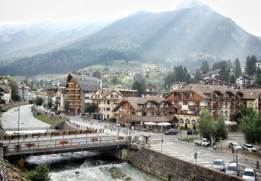
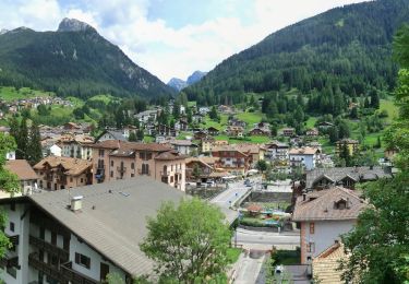
Tocht Te voet van 3,4 km beschikbaar op Trento-Zuid-Tirol, Provincia di Trento, San Giovanni di Fassa. Deze tocht wordt voorgesteld door SityTrail - itinéraires balisés pédestres.
Trail created by AVS Alpenverein Südtirol.
Symbol: 21 on white red flag


Te voet
Te voet
Te voet
Te voet

Te voet
Te voet
Te voet
Te voet
Te voet